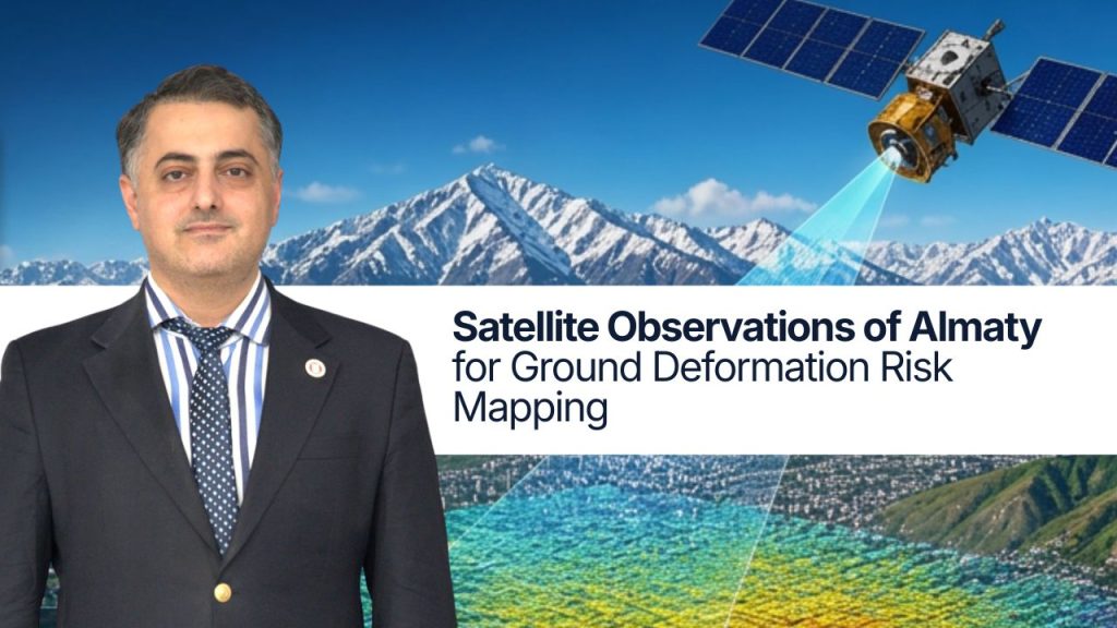
A new study provides the first three-dimensional map of ground deformation across Almaty and surrounding areas, based on seven years of satellite observations independently validated with ground measurements. The study aims to better understand potential risks to infrastructure. The findings can support infrastructure monitoring, geological, geotechnical, and seismic risk assessment, and urban planning.
Published in Advances in Space Research, the study was led by Dr. Emil Bayramov, Associate Professor at Nazarbayev University’s School of Engineering, in collaboration with the Institute of Ionosphere.
The results show a complex pattern of uplift, subsidence, and horizontal movement that varies across the region. The data also provide a more detailed picture of the spatial relationship between these movements and mapped geological faults, while allowing researchers to examine the possible influence of human activity.
“The region is influenced by complex tectonic processes associated with the ongoing collision between plates. We observe both vertical and horizontal ground movements: some areas are rising or subsiding, while others are shifting westward or eastward,” Dr. Bayramov said.
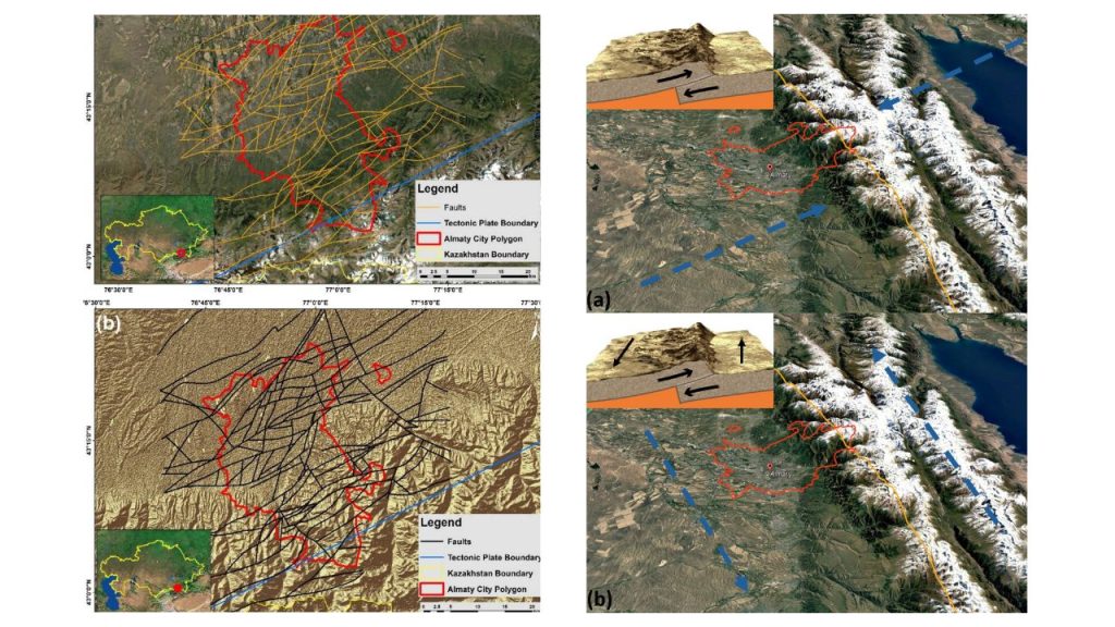
Photo source: Advances in Space Research
Annual vertical deformation velocity ranges from −95 mm of subsidence to +52 mm of uplift. East-west movement ranges from 156 mm westward to 211 mm eastward, while north-south movement ranges from 20 mm southward to 19 mm northward.
One of the study’s key findings is a pronounced transition zone in central Almaty. In this area, uplift in the south changes to subsidence toward the north, while opposing patterns of horizontal movement converge.
“The transition closely follows the Central Almaty Fault, which represents the clearest fault-related deformation zone identified within the study area and exhibits a distinct and spatially consistent surface-deformation signature,” – Dr. Emil Bayramov notes.
Other mapped faults do not show similarly distinct patterns in the available observations. This also may indicate that present-day deformation along these faults is limited, occurs at greater depth, or is too small to be detected reliably with the available data.
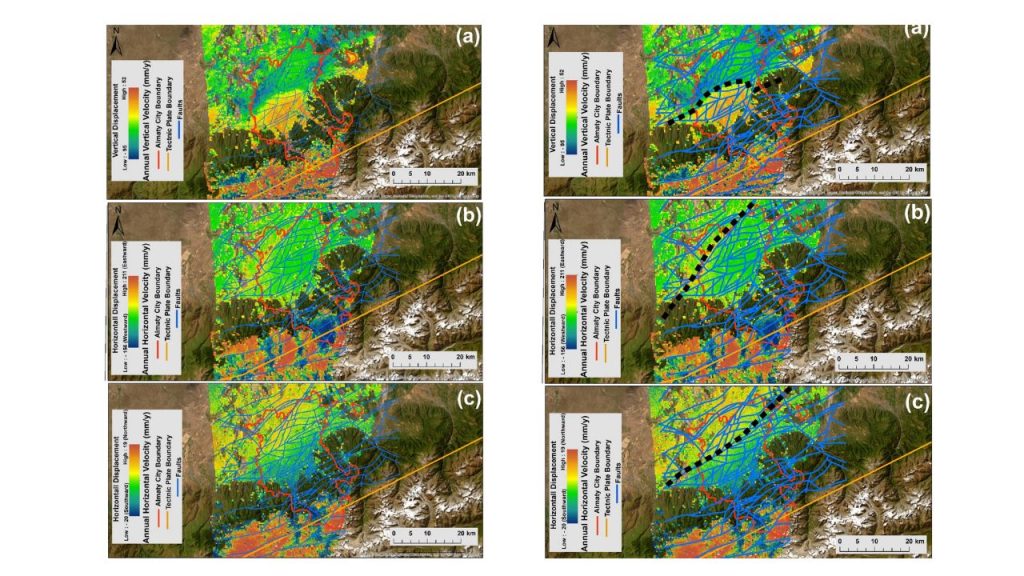
Photo source: Advances in Space Research
Monitoring ground deformation in Almaty is challenging because of the region’s complex terrain and climate. Snow, glaciers, steep slopes and seasonal changes can affect satellite measurements and make it difficult to distinguish long-term deformation from seasonal effects. The researchers accounted for these factors in their analysis and validated the satellite results using independent GPS measurements and documented cases of ground deformation in Almaty, including landslides, building deformation, tilting and cracking, and bridge deformation. The strongest agreement was found for vertical and east-west movements, while the smaller north-south changes were interpreted more cautiously. The observed patterns likely reflect a combination of natural geological processes and human activity. Uplift in the southern mountain areas is consistent with ongoing tectonic processes, while localized subsidence in urban and lowland areas may also be influenced by groundwater use, construction and other human activities.
The findings can support more detailed monitoring of urban infrastructure, seismic, geological and geotechnical risk assessment, and future urban planning. Areas with the most pronounced deformation patterns, including those around the Central Almaty Fault, could be prioritized for further monitoring and infrastructure assessment. Satellite observations can also help identify locations where additional drone surveys and ground investigations would be most useful. This targeted approach could make monitoring more efficient by directing resources toward areas that require closer study.
“Building on the Almaty study, similar satellite-based ground deformation assessments are now being conducted for Astana and for coastal cities around the Caspian Sea. The broader work is intended to support urban safety, infrastructure monitoring, risk assessment and more targeted field inspections across these areas,” Dr. Bayramov said.
The study does not conclude that all detected ground movements are directly associated with active faults, nor is it intended to predict earthquakes. Rather, it provides a detailed picture of where and how the ground is moving and establishes a basis for further research into the geological, tectonic and anthropogenic processes (e.g., groundwater extraction, intensive construction and excavation, urban loading from buildings and infrastructure, underground engineering works, and land-use changes) driving these changes.