

The cultural and historical heritage of Central Asia, and Kazakhstan in particular, includes architectural monuments, archaeological sites, sacred places, natural landscapes, and urban spaces. Many of these sites are increasingly vulnerable to deterioration caused by time, climate change, natural processes, urbanization, inadequate restoration, infrastructure development, and vandalism. As a result, some of these irreplaceable assets are at risk of being lost permanently.
To address this challenge, Ardak Mukanova and Anvar Musrepov launched LiDAR Heritage Kazakhstan, an initiative dedicated to the digital preservation of the country’s cultural and natural heritage through advanced 3D scanning and documentation technologies.
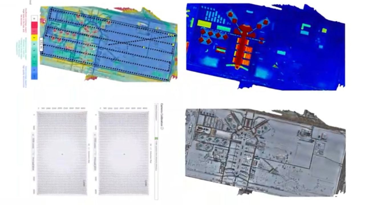
The project is based at Kazakhstan’s first Art&Tech laboratory within the NU Өnergy Creative Hub and applies LiDAR technologies in close collaboration with researchers at Nazarbayev University. According to the team, this interdisciplinary approach goes beyond creating visual 3D models and instead builds a comprehensive scientific database that integrates knowledge from geodesy, archaeology, architecture, biology, ecology, digital humanities, and museology.
Researchers emphasize that LiDAR technology enables the capture not only of the visual appearance of an object but also its precise spatial properties — including geometry, topography, structural composition, deformation patterns, and environmental context.
“We view cultural heritage as a complex data system, where what matters is not only the visual representation of an object, but also its precise spatial structure and scientific context,” said co-founder Anvar Musrepov.
The project aims to create digital replicas of museums, monuments, and archaeological sites using VR and AR technologies, develop 3D mapping solutions, and build educational programs. It also seeks to contribute to the development of a national market for digital expertise in cultural heritage preservation.
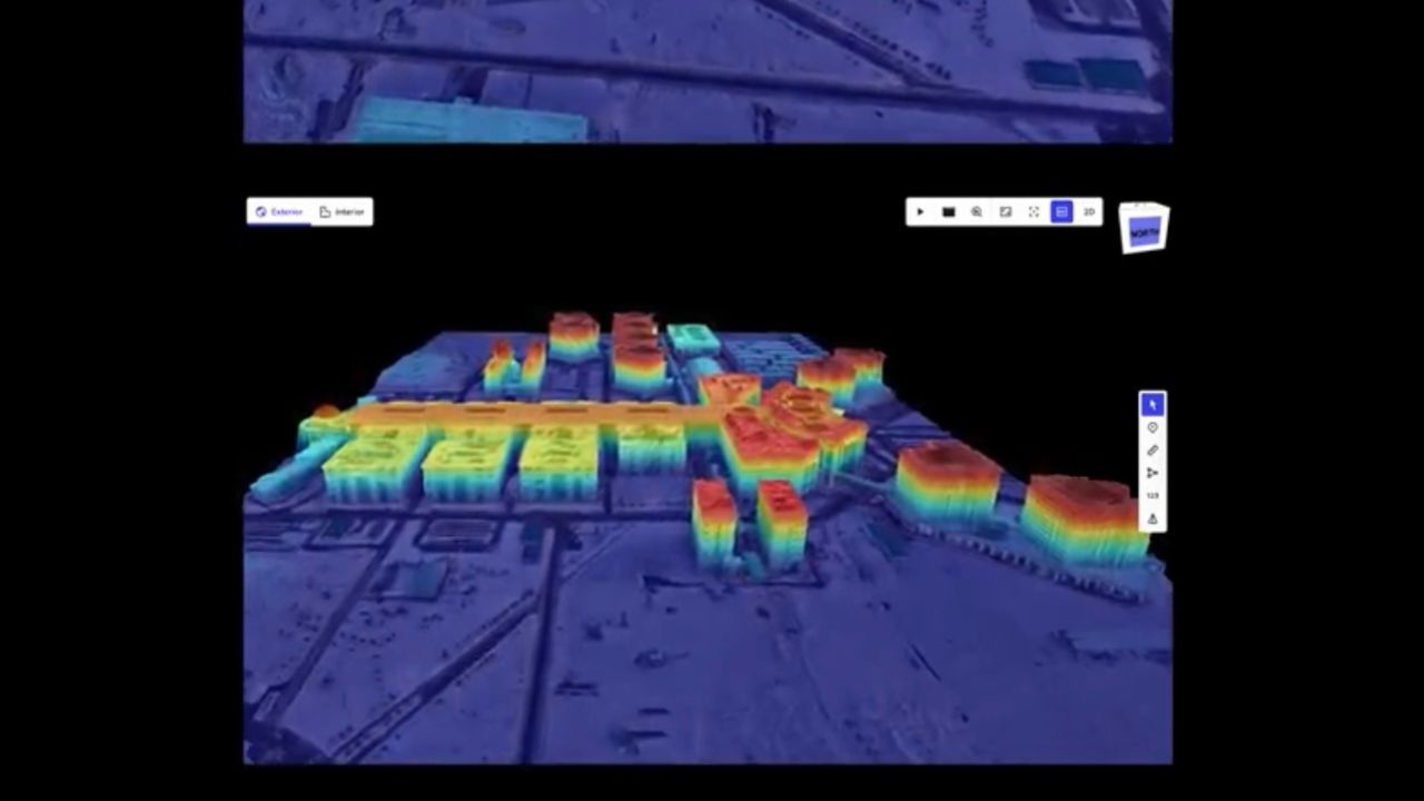
The team has already identified several key sites for digitization, including the Mausoleum of Khoja Ahmed Yasawi, the underground mosques of Shopan-Ata and Beket-Ata, the petroglyphs of Tamgaly, and ancient burial mounds and settlements in the Zhambyl, Almaty, and Mangistau regions. In the initial phase, the team has already scanned the Nazarbayev University campus park and the Mausoleum of Arystan Bab, marking the first steps toward building Kazakhstan’s digital heritage archive.
“In many countries, national digital heritage databases already exist, where LiDAR is widely used in archaeology, restoration, and urban planning. For Kazakhstan and the wider Central Asian region, this project could become one of the first large-scale, systematic efforts of its kind,” Musrepov said.
He added that the key value of the initiative lies in creating a long-term digital archive: even if a site is damaged or lost, its high-precision digital replica will remain available for research, restoration, and public access.
In the coming years, the project plans to expand its database and strengthen collaboration with Nazarbayev University. Together with university researchers, the team aims to build an interdisciplinary analytical framework integrating geodesy, archaeology, biology, ecology, architecture, and digital technologies.
A parallel focus will be placed on public engagement and education, including lectures, workshops, exhibitions, VR/AR installations, city mapping festivals, and training programs for students, schoolchildren, museum professionals, architects, and cultural heritage specialists.


